FLIGHT WORLD
Playing Flight World
This page is work in progress. Information are being added and edited on daily basis.
Anything unclear pop a mail to flight@walen.se
Gameplay
Creating A Single Flight
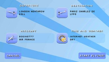
This is the "Create Flight" menu which allows you to select departure and destination which is mandatory before flying.
Click on the aircraft button to select aircraft and airline.
Click on the weather button to set flying conditions.
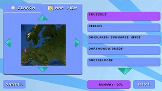
This is the menu for selecting departure and destination airport.
First tab let you search by airport name or ICAO.
Second map view tab let you tap on a position listing airports close by.
The left side lists any matches found.
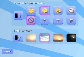
This is the weather conditions and time of day menu.
If you wish to enable realtime internet weather simply click on the mobile/wifi button. Please note this require you to be connected to internet while flying. The data retrieved is minimal.
Bottom rows allows you to set either dawn, day, dusk or night flying.
Button on far right will select this automatically based on mobile system time.
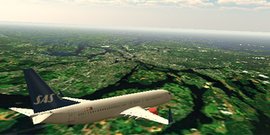
Single Flight - Flying
work in progress...
Settings
Devices with low performance
Even if you have a devices with low performance you should still be able enjoy a smooth experience.
Here are some key settings to get better performance:
Turn off generation of buildings.
Go to scenery settings, set "City Autogen Density" to None.
Turn off in flight city labels.
Go to HUD settings, untick "City Name Labels"
Lower terrain quality.
Go to terrain settings, lower texture quality filter and terrain geometry detail.
Turn off lens effects.
Go to fx settings, untick "Lens effects" and "Wind effects"
Scenery
City Autogen Density: How dense city meshes should be generated
City Autogen Areas: Which areas should be filled with meshes, only city centers or everything including suburb areas.
City Autogen Meshes: Which geometry to use on instancing. (Temporarily)
Terrain
Terrain Shading: Choose between "Painted Texture" or "Satellite Imagery". Please note satellite is only available when your device is connected to internet. This might be data heavy so please make sure to be connected to a WiFi.
Satellite Resolution: What satellite source resolution to use. The higher the slower the gathering will take. *
Terrain Cache Size: Max size of the terrain hold in memory can be. *
Texture Quality: Filtering quality of textures.
Geometry Detail: Geometry detail of the terrain.
Geometry Quality Filter: Geometry detail fall off.
* Choosing a value which is too large for the memory available in your device might result in a force quit of the application.
HUD
ILS: Draw ILS marker on the screen while landing.
Airport Name: Shows a name label over the position of an airport. (Temporarily)
Airport ICAO: Shows a airport ICAO label over the position of an airport. (Temporarily)
City Name: Shows a name label over the position of a city.
FX
Wind Effects: Draw wing wind effects.
Rain Effects: Draw rain.
Airplane Shadow: Draw shadow of the aircraft.
High Resolution Sky: Sky rendered with high resolution.
Lens Effects: Lens flare/glare.
Only Generate App/Dep Runways: Only generate runways for the airports chosen to fly between. (Temporarily)
Audio
ATC Spoken Language: Language spoken by the ATC controllers. Please note the text displayed in the hud will still be english. (on the todo list to be fixed)
Welcome!
Flight World is an ambitious flying game for smart phones and tablets.
Ios and Windows Mobile versions are in development.
Read More